")
About one and one half miles south of Waldringfield lies the publess Hemley. I have looked online and I cannot see that the Village ever had a pub. In 1855 the Village, described as ‘pleasant’ in the History Gazetteer and Directory of Suffolk, only had 63 souls, 75 acres of water and 750 acres of land. It appeared in the Doomsday book as Hemele and was in the gift of Odo De Campania. In 1855 it had a Church, a Rectory with Rector Richard B. Exton who had gained a BA, but ended up in the middle of nowhere. There were a few other notables. Wm Wood was the Parish Clerk and Sexton with Farmers, Cooper, Hunt and Cross. Reverend Richard came from Chackmore which is not much bigger than Hemley but it is pretty and bears significance because it sits beside the entrance drive to Stowe, a Palladian Mansion. The drive started at Buckingham and finished at a Corinthian arch on top of a hill that fronts the House. I am not sure that you can see the Arch from the front of the mansion which is one of the best that the Georgians could offer. Although now a school the pretty grounds, statues and follies are must for a National Trust visit. The grounds also hold a 9 hole golf course and although not my favourite it does wend its way through the lovely grounds. Last time I spoke to one of the members the NT wanted to move the course to another part of the estate. The members enjoy the food of the chef or cook who previously dolled out the pie and mash at the school, so the club meals tend to reflect what was served in the refectory when she was in charge there. Never been fond of school meals, but I knew I had to clear my plate when I ate there!
Reverend Richard lived in the Rectory in Hemley which looks to be be of reasonable size, and with him his wife and son, also called Richard, and a couple of servants. Ten years later in 1865 he was still Rector of Hemley but by 1867 he had passed. His son, Richard B L Exton took up the Ministry and we find him in Dorset in 1871 at age 25 being the curate of a Church, the name of which is not possible to read from the document I found, but in a guess I would say it would be near to Shaftesbury at the civil parish of Holy Trinity. It looks like he had taken his mother with him but later returned to Suffolk and died in Woodbridge. The pull of Suffolk must have been quite strong for him.
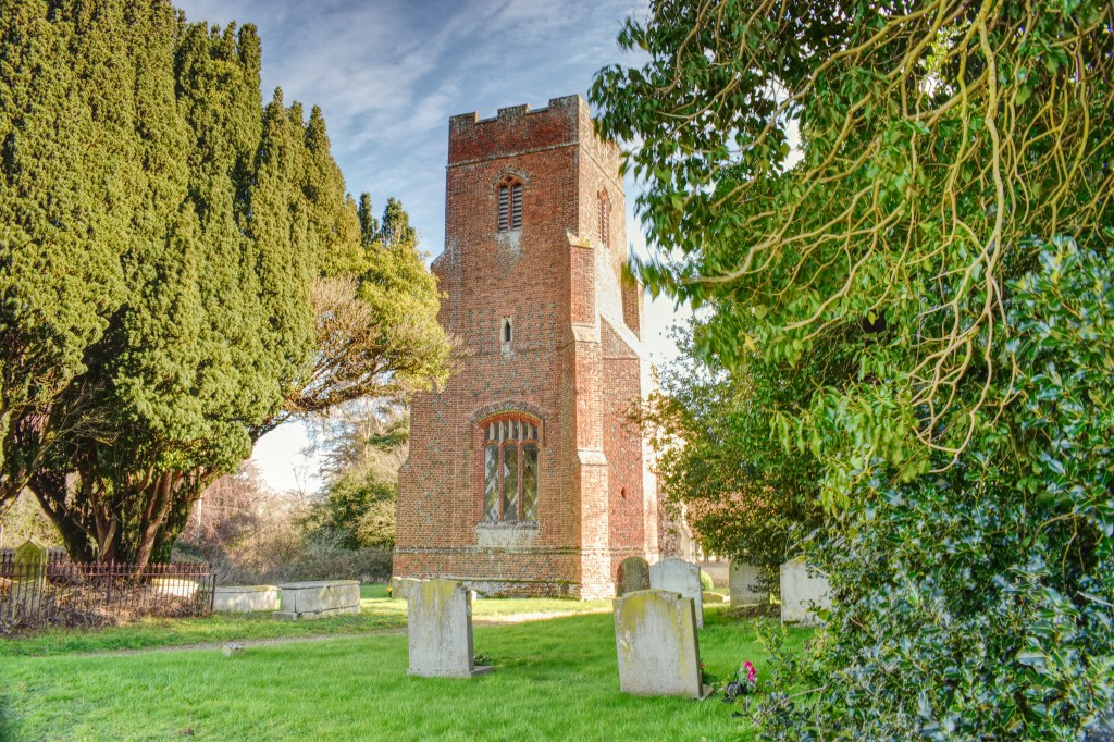
The Church looks to be a carbon copy of the Church in Waldringfield and it is in the centre of the hamlet and stands on a slight rise next to the road that slopes down to the Deben past a few more houses. I am quite taken by the whole of Hemley because it is very pretty, quiet and remote. Whilst taking the photo of the Church the female half of a couple suggested that I came back in the snow when All Saints looks at its best. I think that our church St Margaret takes some beating when looked at from some angles. I will come back in the snow if I can get off the peninsula, perhaps not to take photos but to drink in the prettiness.
Looking at the rest of Hemley in 1851 the majority of the inhabitants were agricultural labourers except for James Cooper, Wright Hunt, and Henry Perl Cross who were the farmers. Cross lived at the Hall to the North of the Church. Not sure that the same is still true now, with mechanisation of farming not needing the same number of workers, but I would venture to suggest that the houses are currently occupied by the retired, second homers or those employed in firms out of the immediate area.
Although the main road, if you can call it that, running through the village is known as Mill Road I can find no evidence of a mill on early ordnance survey maps (1893). The area had two other mills including the one at Waldringfield. The one west of Hemley was water driven by the aptly named stream Mill River which leads down to Kirton Creek just south of the river front of Hemley. The river front was marshland and saltings, but did include a quay although I cannot find out what this was for. Any quay or hard along the Deben was likely to be used to ship out coprolite to Ipswich for processing, or perhaps for a ferry.
The Deben is often called an ancient river and that relates to its use by humans rather than it’s creation which I believe would have been at the end of the last ice age. Certainly if you look at a resource which details the archaeology finds, you can see that shards of flint used by the ancients, through field systems of the Romans, shards of pottery thrown away by the Anglo Saxons to a lot of Medieval finds. When people think of this part of Suffolk they think of Sutton Hoo and the ship burial found by Basil Brown, commissioned by Mrs Pritty. This area is so much more than Sutton Hoo and the Anglo Saxons. If you look at the finds it confirms continuous occupation since, possibly, 30,000 BC, the Stone Age, to the present day. Although no longer a commercial artery, more just fishing and leisure, the Deben must have been traversed by a number of different vessels. Stone age boat builders must have pushed their boats into the waters of the river, although I am not sure of what they would have been built with. There was a lot of heath land on the other side of the river from Hemley and this stretched as far as Snape. There would not have been large areas of forest until the late 19th Century when the rich Manor dwellers planted woods to house their game birds for hunting.
We will continue to be famous for the Anglo Saxon ship burials and The Venerable Bede’s reported Royal Anglo Saxon settlement at Rendlesham, but the Prehistoric to Roman occupation must not be overlooked through it’s field systems and bits of pottery and also the remains of Roman Villas like in other areas of the County. We have a Roman Road at Woodbridge and a Roman Villa at Burgh and I am sure there must be more than just a few shards of Roman pottery this side of the waterway. If you get a chance there is a aerial photo on the wall of the school house at St Botolph’s in Burgh which shows a previous Roman building as field markings surrounding the church. The size is quite impressive so it would not be a stretch of the imagination to think that there may be other Roman buildings built in the same area and this side of the A12. The dry nature of the land makes it a very good place to live and farm even through you may have had to remove a lot of gorse which is the one of the natural plants of on both sides of the Deben.
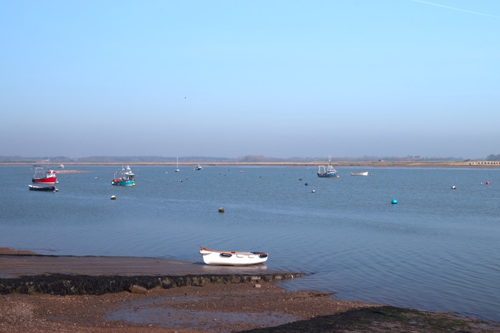
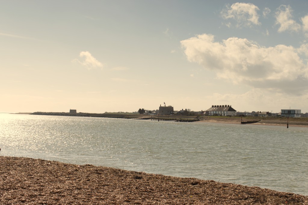
Felixstowe Ferry is south of Hemley and is bigger in terms of buildings than Hemley, and will have more visitors than Hemley being situated as the only crossing from the mouth of the Deben to the bridge at Melton a few miles to the North. Ferries using small boats were a feature of the Deben. Apart from Felixstowe Ferry there were other ferries at Ramsholt and Woodbridge. The only one that remains is the one which transports passengers from Felixstowe Ferry to Bawdsey although the Ferry at Woodbridge run until about 1974. A very ancient crossing towards its later life it bought people from the Sandlings on the East side of the river to shop in Woodbridge. Buses took over hence its demise. In 2021 there was a plan to revive the Ferry to take visitors to the Sutton Hoo exhibition but there were objectors so I cannot find if the plans are extant. So likely that all we will have to remind us of the crossing are place names, Ferry Quay on the Woodbridge side and Ferry Farm and Ferry Cliff on the Sandlings side. A ferry up stream from a certain point on the Deben are constrained by the tide and would need to have very long jetties or a short operating times when the tide is high enough. A key feature of the lower reaches of the river are the mud flats etc that show themselves at low tide.
The crossing Felixstowe Ferry although called a foot ferry will carry bikes, but it does not operate as such except between October and April. There was a vehicular steam power ferry which was commissioned and financed by Sir Cuthbert Quilter so it would make his journey to the train station at Felixstowe easier when he took the train to London for this business interests and attending Parliament. Although the Ferry finally closed in 1933 after 35 years in operation you can still see the landing stages on either side. Sir Cuthbert was a key figure for the area towards the end of the Victorian era. This blog published a post on Sir Cuthbert which still exists if you want to take a look.
Felixstowe Ferry does have a lot of visitors, a pub and a café but the quay is exclusive to the ferry so it does not allow crabbing a particular children’s pastime in Summer. There are plenty of other places to follow this sport if you can call it that! Despite the tides that race by the quays on either side of the Deben there was an annual swimming race, which like a lot of wild water swimming galas stopped because of COVID. I suspect they will start again now or may already have resumed. The tidal wash gets funnelled at this point and it does travel fast especially with hight tides. As with most of the areas with river frontages there is the inevitable sailing club. It was founded as a club in 1934 although sailing and previous clubs had existed since the 1920’s. The sailing club and other boaty type activities make the Ferry a leisure place. There is not even a C of E Church although there is a very nice golf course which lines both sides of the road out of Felixstowe Ferry. Actually there was, in the Victorian era, a Mission Church and a Methodist Church. The coastguard station stood in the area although this has now been re-purposed.

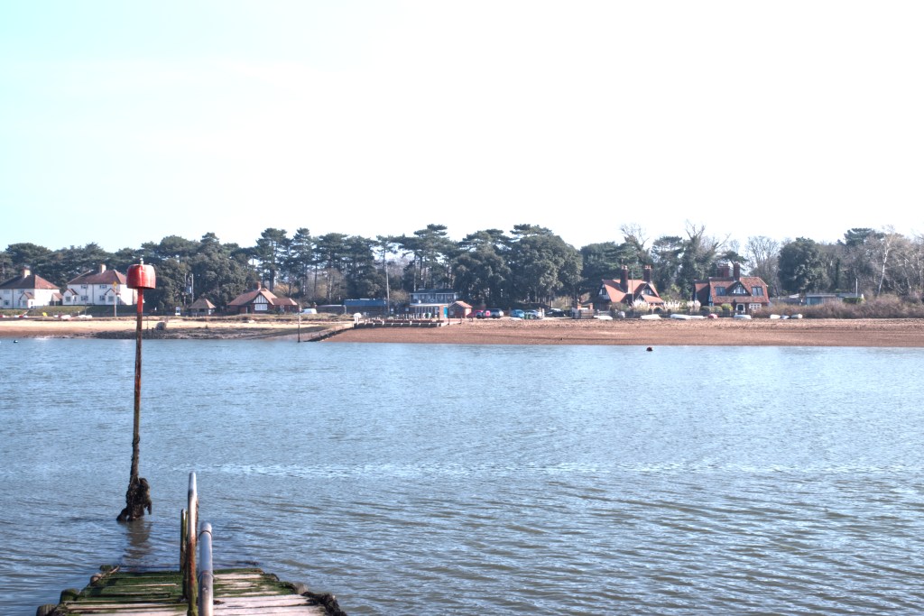
Opposite the Ferry is Bawdsey Quay. One of the few places in this area with a stretch of sand although last time I went there there was a lot of dog poo up by the wartime concrete blocks which were there to deter enemy landings. Wartime defences abound in the area and some especially those at East Lane, Bawdsey, are very impressive.
In the area of the Quay now, there is about ten houses plus Bawdsey Manor, the Mansion built by Sir Cuthbert Quilter as a home, although he did have Hintlesham Hall on the other side of Ipswich. Built in 1886 and enlarged in 1895 it was the principal residence of Sir Cuthbert. Although it was requisitioned in the first World War by the Devonshire Regiment it was returned to the family and remained with them until 1936 when it bought by the Air Ministry as a base to develop Radar. It remained with that organisation until the 1990’s and now has a museum which is worth a visit.

In 1855 at the time of Whites Directory of Suffolk the quay does not get a mention. The area known as Bawdsey Haven is just inside the estuary and includes the low areas of water called the Knolls. There is confusion in some of my source material. The OS maps give the Haven as Woodbridge Haven but in others the Haven is called Bawdsey. In an old OS map dated to around the turn of the 1900’s shows only a couple of buildings which I think pre-date Bawdsey Manor and it’s outbuildings.
When Sir Cuthbert Quilter built the Manor he added a number of additional buildings, which included a dairy a church, a lodge and kennels which no doubt housed his hunting hounds. These were far enough away from the Manor so that they would not wake him with their barking when they were waiting to be fed. The Church Building is not extant, so must have been pulled down. A building called the Kennelman’s cottage still exists, but I cannot make out the Kennels so maybe they were re-purposed during the time the Manor was in the hands of the Air Ministry. Bawdsey Quay in1855 was without church or pub although for salvation or thirst quenching the locals could have used the Ferry to get across to Felixstowe Ferry to visit the Victoria Arms or Ferryboat Inn or the Methodist Chapel. If you did want to worship at a C. of E. Church It was a long hike to St Mary the Virgin which is within Bawdsey, the Village.
The row of houses next to the sandy beach are upstream from the quay itself. They must be quite desirable except that the view would be tainted in spring, summer and autumn by the row of campervans which park on the opposite side of the road. These are now discouraged by a set of very ugly and what look to be temporary red and white bollards set in the places where the campervans once parked. Aesthetically I prefer the campervans. The quay itself which is used by the foot ferry this side of the Deben few buildings now but does have tea house, the Boathouse Cafe, which serves very nice cakes. During the summer months you need to get there early because the quay and beach is very attractive to visitors. In the later autumn months, winter and early spring then it is quiet like the rest of the Peninsula.
Like most of the quays along the lower part of the river Bawdsey quay would have been used to ship out the Coprolite. Coprolite, or fossilised dinosaur poo, would have been dug up anywhere from Bawdsey to Boyton on this side of the Deben. In 1855 Whites Directory specifically mentions the Coprolite industry and I have read other articles of children collecting the dung stones from Bawdsey beach including one sad story of a young girl whilst collecting was buried under a cliff fall, an ever present feature of the soft cliffs along the Bawdsey North Sea Coast. These cliffs are around the headland from the quay. The mouth of the river on the Bawdsey side is a short walk from the Quay.
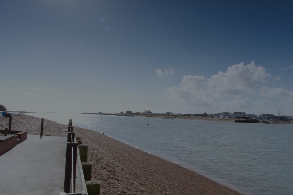
The bar to the entrance to the Deben, often called the Knolls, is a block for large boats and only smaller vessels can get over preferably on a rising tide. There is an interesting article https://www.classicboat.co.uk/practical-advice/seamanship/why-the-river-deben-is-worth-navigating/ which gives more detail on these Knolls and further issues up stream. I am not a sailor but I did find the article a very interesting read.
